Codename: KRU
A remote monitoring system for the environmental impact of blasting operations
About the product
KRU is a digital monitoring platform for slope and dump stability at open-pit coal mines. It aggregates geotechnical sensor data and shows site status in real time. Dispatchers use it to monitor deviations and respond quickly to prevent incidents and protect people and equipment.
Problem
The existing monitoring system had an outdated and overloaded interface with overly harsh colors, fragmented data display, and high dependence on expert knowledge. This slowed dispatcher perception and increased error risk in critical situations.
Solution
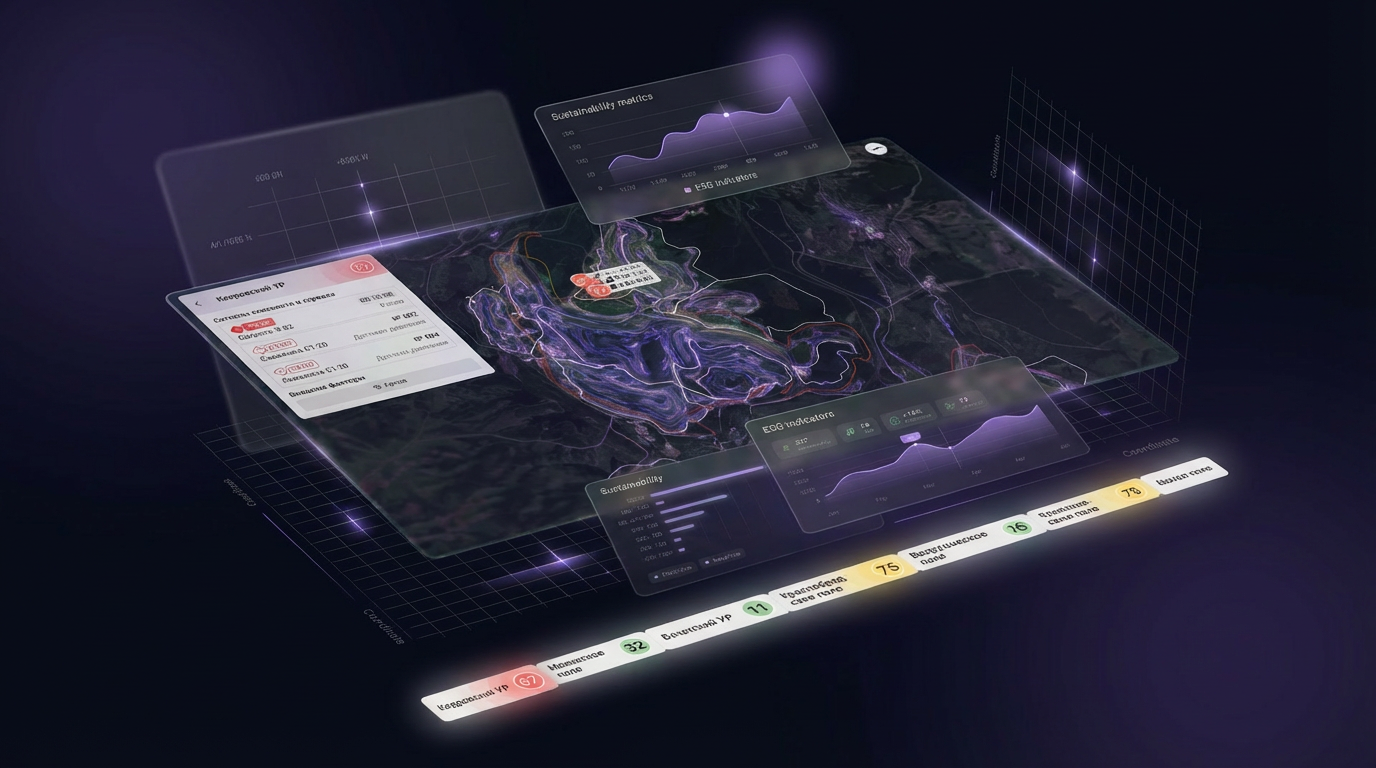
Redesign the system with a focus on readability, data hierarchy, and lower cognitive load. Then scale it into a geospatial monitoring platform.
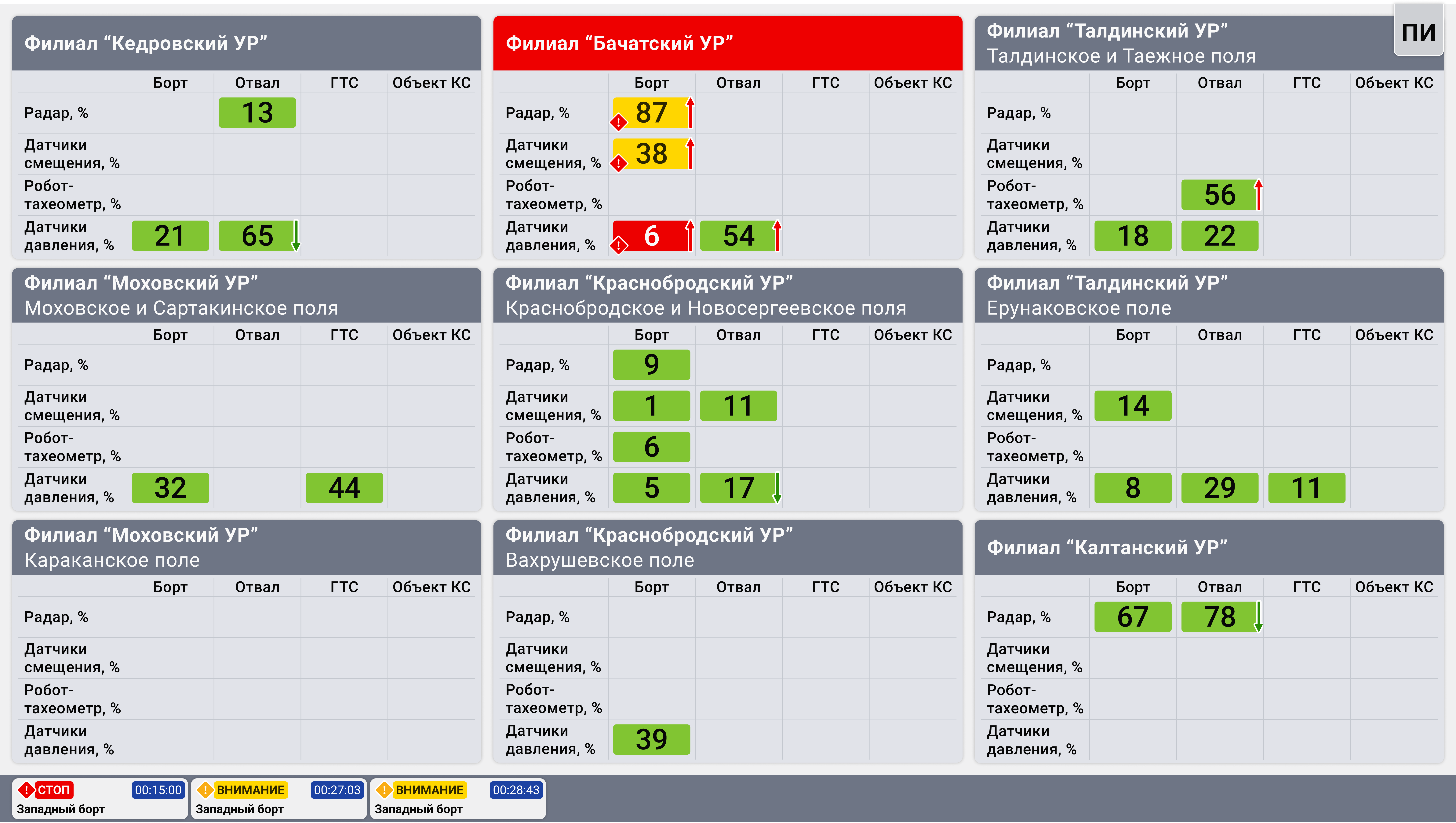
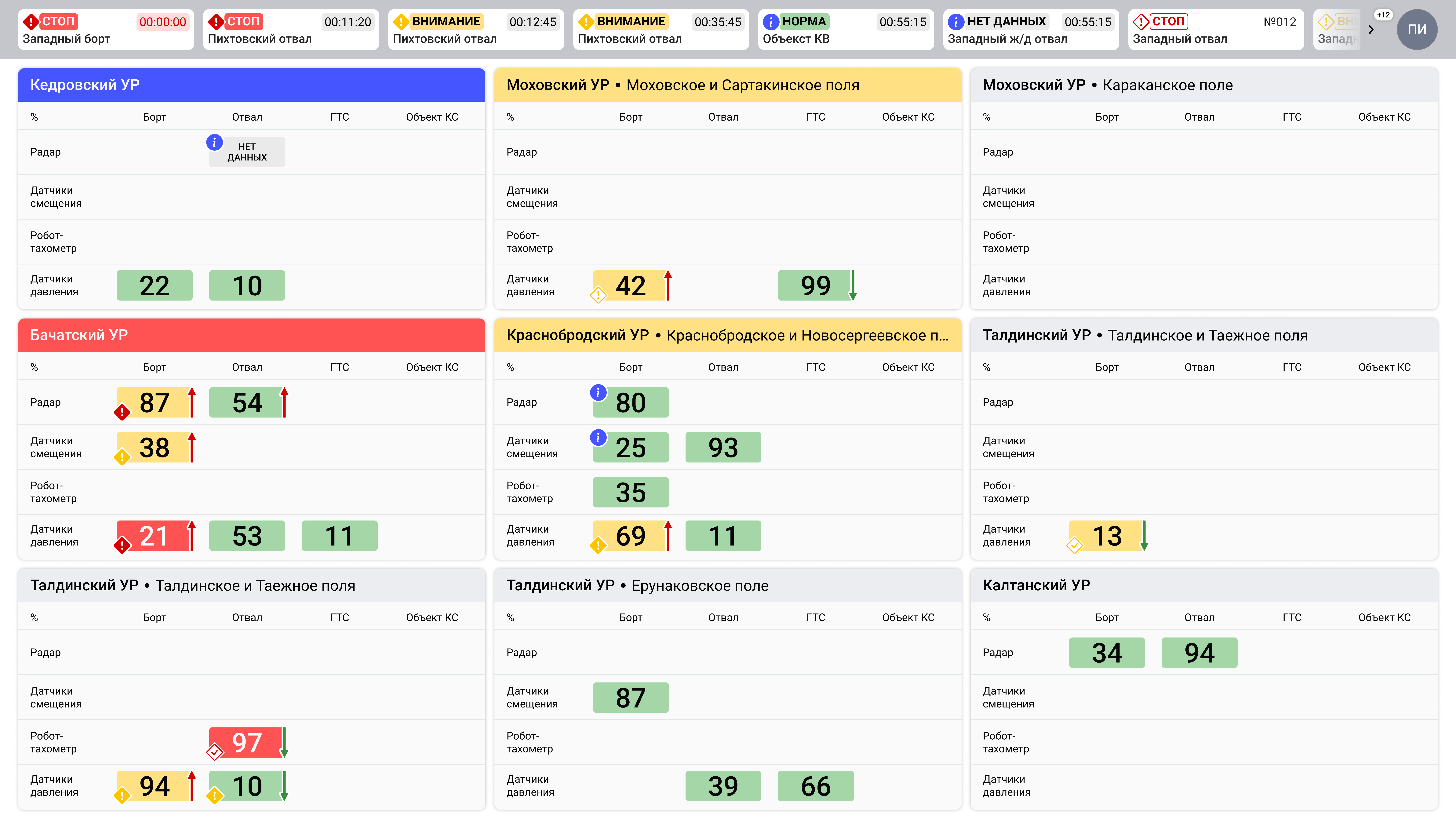
Left: before redesign. Right: after redesign.
Process
Audit and discovery
- Audited the current UI and identified bottlenecks
- Collected requirements and mapped dispatcher workflows
Redesign
- Updated color system for critical deviation visualization
- Reworked nesting logic and data hierarchy
- Optimized interface layout for faster perception
Platform development
- Extended capabilities with map-based indicators linked to high-resolution orthophotos
- Designed incident response workflows
- Designed reporting workflows
Validation with stakeholders
- Built clickable prototypes
- Ran user testing with dispatchers
Delivery
- Built a unified design system
- Prepared developer specs
- Supported implementation and rollout
Design QA
- Tested production UX quality
- Polished UX solutions together with engineering
Project gallery
Result
The interface became more readable and cohesive, lowering onboarding effort. Transition to a map platform helped dispatchers assess field conditions faster and trigger response actions sooner in critical cases.